week6
Topic is earthquake cloud.
Mechanism of the earthquake cloud
At present, neither the elucidation nor the actual proof is carried out about the generating mechanism of earthquake clouds. However, some mechanisms are shown as a hypothesis. As for a typical hypothesis, the electromagnetic waves which occur from the focus circumference affect generation of clouds. Although it is assumption, the high voltage is built over the atmosphere according to the piezo-electric phenomenon of an underground base rock. And when electrified vapor moves in the direction of a wind in geomagnetism, it gathers in the direction which contracts vapor itself, and the power of the emission contraction by magnetism is added up and down. It makes vapor in a thin atmospheric shell the clouds of a unique form, and becomes earthquake clouds.
Important things are electromagnetic waves.... although it is too difficult for me to understand it well.

The kind of earthquake clouds
The form of earthquake clouds is various. The more the dreadfulness and the eeriness which are felt from earthquake clouds are strong,it is said that an earthquake becomes large. However, since it may mistake by the clouds and jet stream on the weather, cautions are required.
The feature and form of earthquake clouds are introduced based on the shape of nine kinds of earthquake cloud shapes.
The feature and form of earthquake clouds are introduced based on the shape of nine kinds of earthquake cloud shapes.

It seems that the form divided empty by clouds and a blue sky.
The shake of the occurring earthquake is
large.

The clouds of a form like a rib.
In many cases, An earthquake happens on the
witnessed day.

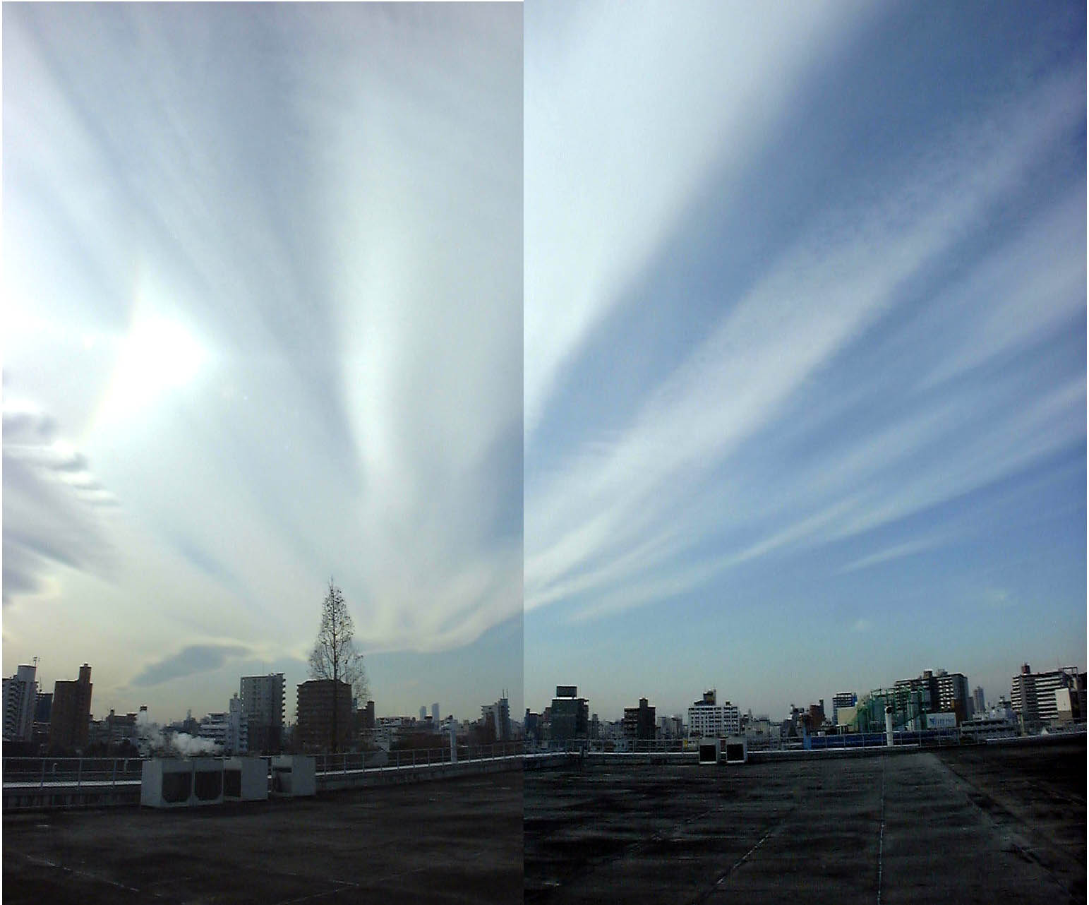
The clouds extended in a straight line.
It has most numbers of eyewitnessings of
earthquake clouds.

The clouds of a form like the ripple which spreads on the water surface.
The central point of a ripple is the focus.

The clouds of a form like beans.
An earthquake occurs within several days
after eye witnessing.

Clouds are radiantly extended mainly in case of the focus.
An earthquake occurs within several days.

The cloud is carried out the form of the bow.
An earthquake occurrence is carried out
within 2 or 3 days in many cases.

The clouds of a form like thunder.
An earthquake occurs within two days.

The clouds of a form like the smoke which rises.
The range just under clouds is the focus.
I was surprised for me to have many kinds.
An earthquake may occur.
○03/01/08 00:28:37 20.42S 174.75W 83.4 5.7M A TONGA ISLANDS
03/01/08 04:45:04 9.42S 75.51W 35.4 5.1M A CENTRAL PERU
03/01/08 14:29:10 6.12N 77.21W 33.0 5.4M NEAR WEST COAST OF COLOMBIA
03/01/08 17:15:08 52.05N 171.51W 33.0 5.2M FOX ISLANDS, ALEUTIAN ISLANDS
○03/01/09 02:50:49 19.45S 176.51W 33.0 5.8M FIJI ISLANDS REGION 03/01/09 03:40:25 0.15N 123.62E 106.0 5.2M MINAHASSA PENINSULA, SULAWESI
03/01/09 04:14:21 36.78N 141.11E 33.0 5.1M NEAR EAST COAST OF HONSHU, JAP
○03/01/09 04:42:42 0.61N 98.66E 33.0 5.8M NORTHERN SUMATRA, INDONESIA 03/01/09 07:02:57 18.15S 70.96W 33.0 5.4M NEAR COAST OF NORTHERN CHILE
03/01/09 15:43:55 59.99S 58.29W 10.0 5.1M B SCOTIA SEA
03/01/10 02:08:03 17.13N 100.03W 62.1 5.0M A GUERRERO, MEXICO
◎03/01/10 13:11:56 5.23S 153.55E 70.9 6.7M A NEW IRELAND REGION, P.N.G.
○03/01/10 15:18:55 0.16N 97.88E 33.0 5.7M A NORTHERN SUMATRA, INDONESIA 03/01/10 15:26:00 0.21N 97.80E 33.0 5.4M B NORTHERN SUMATRA, INDONESIA
03/01/10 18:19:07 15.77S 174.40W 33.0 5.0M B TONGA ISLANDS

関東地方 05/16 17:22 30.2N 142.1E 33k 4.5M B 伊豆諸島の鳥島近海
関東地方 05/17 23:18 36.7N 141.6E 20k M4.2 茨城県沖
○北海道地方 05/18 01:04 43.5N 147.3E 33k 4.4M B 北海道東沖
近畿地方 05/18 16:28 34.4N 136.2E 374k 4.6M A 奈良県と三重県の境
北海道地方 05/21 12:08 43.2N 145.9E 50k M4.2 北海道東部の根室半島南東沖
東北地方 05/21 14:25 40.9N 143.3E 浅い M5.1 三陸沖(東北の東)
0 件のコメント:
コメントを投稿